Summer in Portland is all about sour beer, outdoor concerts, and weird traditions like the Adult Soapbox Derby. It's also that time of year when the sands of Sauvie Island resemble a scene from a '60s beach party film, only with a lot more naked people.
Nonetheless, while a steady supply of sunshine certainly livens Portland up, most of us are actually itching to get away and enjoy the outdoor playground that is the rest of Oregon. But what if you don't have time to embark on a Kerouacian odyssey this summer?
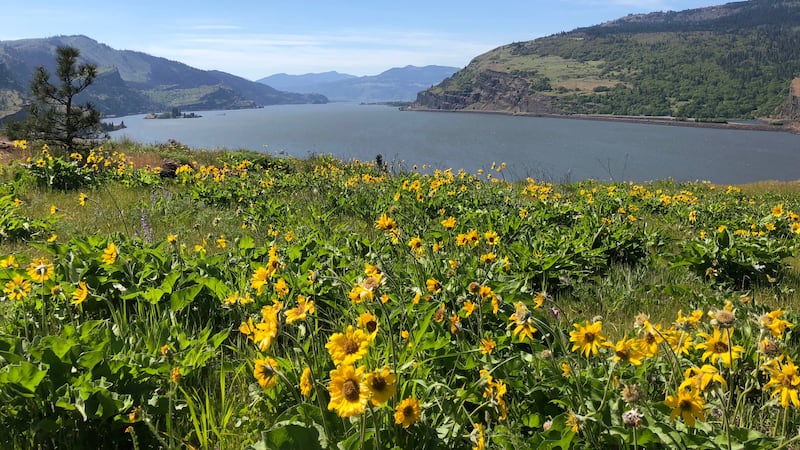
Here are several spots where you can hike, swim, kayak and even learn about Oregon's covered bridges. And they're all no more than a two-hour drive from Portland.

Milo McIver State Park
Where is it? Situated along the Clackamas River near Estacada.
What can you do there? Kayaking, canoeing, rafting, hiking, disc golf, fishing, horseback riding.
How far is the drive? About 45 minutes.
Milo McIver State Park is the perfect spot if you're just looking to chill out. Named after a former member of the Oregon State Highway Commission, the park resides along the Clackamas River a far sight from any major highway, which is a good thing. The park has two sections, although if hiking, avoid the Riverside day-use area by all means, since it's pretty much all equestrian trails—unless you don't mind sidestepping horse droppings every 10 feet. Rather, park in the Riverbend day-use area and take the Maple Ridge Trail through a mossy forest of red cedar, big leaf maple, hemlock, red alder and cottonwood. For a longer hike, park at the Milo McIver Memorial Viewpoint and hang a left toward Kingfisher Camp after indulging yourself with views of Mount Hood and the Clackamas River.
There are also opportunities for kayaking, rafting and canoeing, although take note that the current can be strong. If exploring via river sounds like too much work or just plain treacherous, bring a cooler and spend a lazy day at the 27-hole disc golf course. Nobody will judge.
On your way back: Visit the beer garden at View Point Restaurant & Lounge (20189 S Springwater Road, Estacada), where you can take in views of Mount Hood while downing some pints. View Point also offers a barbecue menu, horseshoes, cornhole and live music on Sundays.
Directions: Follow Southeast McLoughlin Boulevard south and merge onto the Clackamas/Estacada ramp for OR 224 east. Drive about 6 miles and turn left onto OR 212 E/OR 224 E. Take a slight right to stay on 224 east and then turn right onto Market Road 39. Continue on South Springwater Road for 10 miles and you'll see a sign for Milo McIver State Park. Make a left into the park. There's a $5 day-use fee.
Sand Island Marine Park
Where is it? On an island in St. Helens, about a five-minute boat ride from the marina.
What can you do there? Kayak the Columbia, relax on the beach, picnic, hike along nature trails.
How far is the drive? 45 minutes.
Once it hits 80 degrees, city dwellers will inevitably migrate to Sauvie Island. Although, when half of Portland is headed to the same place, it's not that fun anymore. Perhaps it's the summer crowds or the new alcohol ban—or both—but maybe it's time to explore other options. Sand Island Marine Park, located in St. Helens, is one of those options. There's just one hurdle—you can only reach the island by boat. If you don't own a boat but have experience navigating rivers by kayak, you can remedy the situation by renting gear at one of Portland's retailers, like Next Adventure Paddle Sports Center or Portland Kayak Company. There's a boat launch at the north end of St. Helens Marina and it's just a quick row to the island. Again, attempt this only if you have kayaking skills. Scappoose Bay Paddling Center also runs kayaking tours to Sand Island.
Unlike Sauvie Island, Sand Island doesn't have U-pick farms or summer concerts. But if you're just looking to relax, that doesn't matter anyway. There are beaches, picnic shelters, restrooms, fire pits, and 37 campsites if you want to make a weekend of it. The island also has hiking trails where it's likely you'll spot some wildlife, and if you're feeling adventurous, you can climb the treacherous-looking sand dunes along the backshore.
On your way back: Grab some craft beer and play a board game at Running Dogs Brewery (291 S 1st St.), a cozy local watering hole in downtown St. Helens.
Directions: From I-405 north, take exit 3 for US 30 west toward St. Helens. After driving 24 miles, turn right onto Bennett Road and then left onto Old Portland Road. After another 2 miles, turn right onto Gable Road for a mile and a half, then turn left onto South River Street. Continue north to the St. Helens Marina.
Mosier Creek Falls
Where is it? Along Mosier's Pocket Park Trail, where the waterfall plunges down Mosier Creek Gorge.
What can you do there? Hiking, swimming.
How far is the drive? An hour.
Mosier Plateau is arguably one of the best spots in the Gorge for springtime wildflower hikes, but there's yet another reason you should tackle the hour drive from Portland—the place has a sweet swimming hole. There's no official trailhead, but as you're heading through Mosier on Highway 30, park in the lot at Totem Poll Plaza. Walk across the white bridge over Mosier Creek and you'll see a roadside bench and a trail. This where you begin the hike, which is 3.5 miles if you hike the entire plateau loop.
Along the trail, you'll pass a pioneer cemetery with graves for the Mosier family. Soon enough, you'll pass some houses overlooking the creek that will make you envious of whoever lives there. You'll also pass a viewpoint of the idyllic Mosier Creek Falls. The swimming hole is nestled between the upper and lower falls, and you can even cliff jump into the crystalline waters—just make sure to check for deep spots before doing so. Of course, you can continue hiking up to the plateau, but keep in mind that the trail has very little shade.
On your way back: Finish with a round of craft ciders at Rack & Cloth (1104 1st Ave.), a restaurant in Mosier that also offers a selection of local wines and a small seasonal food menu of pizza, soup and salads.
Directions: From I-84 east, take exit 69 for US 30 toward Mosier and turn right. Drive half a mile and you'll see the Totem Poll Plaza. Park there. Walk across the white bridge and the trail is on the right.

Wilson River Trail
Where is it? Situated within the Tillamook Forest in Oregon's Coast Range.
What can you do there? In addition to hiking, you can swim, mountain bike, and visit the Tillamook Forest Center, where you'll find exhibits and can even climb a 40-foot replica of a fire lookout.
How far is the drive? An hour.
Burrowed in the Tillamook State Forest, the 22-mile Wilson River Trail offers year-round hiking, and depending on which section you want to do, the levels range from leisurely strolls to some dedicated ascents. Come summer, hiking the trail has an added bonus due to a number of swimming holes that dot the river. While you could very well visit just one of the swimming holes, the 7-mile trail between Jones Creek and Wilson River Footbridge weaves along the river through a mossy forest of alder, big leaf maple, cedar and fern.
As far as which swimming hole to visit, it's really a choose-your-own-adventure kind of deal. The Smith Homestead day-use area, close to the Tillamook Forest Center, has deep, clear pools with river-rock beaches, although you'll need to reserve ahead for picnic shelter use. The Footbridge day-use area has deep and shallow sections, so it depends on whether you're looking to sunbathe on the rocks or head upriver to the Wilson River Footbridge for swimming and cliff jumping. If you're looking for something quieter, park at milepost 15, where the river bends and slows into a sparkling deep pool. These are just a few examples of swimming holes here, although you'll definitely find more along the way. Again, check any spots you're planning to jump into, and it's recommended to wear water shoes for traction. If parking at Tillamook Forest Center, remember that the gates are locked at closing time, so you'll have no way to get out.
On your way back: Stop at Helvetia Tavern (10275 NW Helvetia Road), an old roadhouse north of Hillsboro known for its gigantic hamburgers.
Directions: From US 26 west, bear left onto OR 6 toward Banks and Tillamook. Drive 28.9 miles and turn right onto Jones Creek Road. Drive 0.1 miles, where you'll pass the Smith Homestead day-use area and cross the Wilson River. Turn left into the Jones Creek day-use area.

Linn County Covered Bridge Tour
Where is it? Linn County lies midway through Oregon's Willamette Valley, noted for its scenic countryside and friendly small towns.
What can you do there? Tour covered bridges, Albany's historic districts and the Historic Carousel and Museum; swimming holes.
How far is the drive? A little over an hour.
Fun fact: Oregon has more covered bridges than any other state west of the Mississippi. But why did folks take the trouble to cover bridges in the first place? Before steel and concrete became the norm, bridges were built out of wood, and the cover helped prevent it from rotting away in the rainy Northwest climate. Also, there was a shortage of steel during the world wars, so covered bridges continued to be built due to the abundance of Douglas firs.
The covered bridge loop takes you along winding country roads and rolling hills, not to mention a couple of swimming holes, and it can be driven or cycled. The Albany Visitor Association website has a PDF with turn-by-turn directions and some historical information. There are nine covered bridges in Linn County, although if you're short on time, do the 47-mile, five-bridge loop around Scio, which begins at Hoffman Bridge. After Gilkey Bridge, you'll come to Shimanek Bridge, where you should take a detour to downtown Scio and grab lunch at the Covered Bridge Coffee House. The last two bridges, Hannah and Larwood, have swimming holes under them, and there's also a fish hatchery near Larwood.
On your way back: Grab a pint in Scio at the Olde Silver Dollar (38726 N Main St.)—the only bar in town, but a good one.
Directions: From I-5 south, take exit 233 toward Lebanon/Sweet Home and merge onto US 20 east. After about 6 miles, turn left onto OR 226 east, and go another 2.5 miles before turning left onto Cold Springs Road. Turn right at Crabtree Drive and then left onto Hungry Hill Road. Drive another mile and a half until you reach Hoffman Bridge.
Boulder Lake
Where is it? In Mount Hood National Forest near Bonney Meadows Campground.
What can you do there? Hike, swim, picnic.
How far is the drive? Two hours.
Most flock to Timothy Lake or Trillium Lake for a quick summer getaway. But if you're looking to go a little more off the beaten path, Boulder Lake, cradled in a lone corner of Mount Hood National Forest, is a nice alternative. Encircled by a ring of evergreens, it's the kind of lake featured in old summer vacation movies, and you may even be inspired to re-enact the lift scene from Dirty Dancing. A prime swimming locale, it's the perfect place to bring a floatie and bask in the calming pool of water.
If you want to get in a hike, there's a loop trail starting at Boulder Lake Trailhead. After passing through a thicket of alder and willow, you'll pass Spinning Lake and follow the trail toward Little Boulder Lake, the "Mini-Me" to Boulder Lake. The trail soon climbs though a noble fir forest to Echo Point, where you can take the loop through Bonney Meadows and ramble among the wildflowers. If you come in early August, the area is filled with butterflies.
On your way back: Cap the day with some fresh brews and grub at the rustic Mount Hood Brewing Company (87304 Government Camp Loop).
Directions: From I-84 east, take exit 16 for 238th Drive toward Wood Village and turn right onto Northeast 238th Drive. Continue onto Northeast 242nd Drive and drive almost 2 miles before turning left onto Northeast Burnside Road. Continue straight onto US 26 east and after 40 miles, take the exit for OR 35 north toward Hood River. Continue on 35 for 44 miles, then turn right onto NF 48. Drive 6.8 miles and turn left onto NF 4890 and continue straight onto NF 4881. After driving 2.5 miles, turn left onto NF 4880 and the trailhead will be on your left.

White River Falls State Park
Where is it? Just east of Tygh Valley in Maupin, 34 miles southeast of The Dalles.
What can you do there? Picnicking, fishing, swimming, hiking—oh, and you can also explore an abandoned power plant.
How far is the drive? Two hours.
White River Falls State Park has stayed under the radar, and its remote location just east of Tygh Valley is most likely the reason. A far cry from the lush landscape surrounding Portland, White River Falls is located east of Mount Hood, and the rugged canyon terrain makes for a different kind of adventure altogether.
The 90-foot waterfall plunges over a basalt shelf, and you can view the two-tiered fall from a railed lookout. As you descend the railroad-tie steps, you'll come to an abandoned hydroelectric plant that supplied electricity to the area from 1910 to 1960. Still fairly intact, you can walk through the plant and explore its rusty remains, some of which are now decorated in graffiti art. There's a small beach at the base of the waterfall, which is ideal for picnicking and fishing, and sometimes swimming. Just remember it's a wild river, so please use common sense. To access the second (superior) swimming hole, hike along the sagebrush-lined trail to the 15-foot Lower White River Falls, where you'll find a nice dipping pool. The park closes at dusk, so plan accordingly. Visit in early summer when the current is stronger, and also bring insect repellent and plenty of drinking water.
On your way back: Have dinner and drinks at Baldwin Saloon (205 Court St.) in The Dalles, an old-timey tavern where everything is made from scratch.
Directions: From I-84 E, take Exit 87 for US 197 toward Dufur/Bend. Continue for 28 miles and turn left onto OR 216 east. Drive another 4 miles until you reach the park entrance on your right.

Seven Awesome Day Trips | The Best Open Gorge Trails | Bear-Fat Doughnuts | Oregon Rodeo Celebrities | Urban Ax Throwing | Cold Dark Places | Summer Super Calendar