As Portland braces for another long, rainy winter, we take comfort in ramen and Spanish coffee. We also take comfort in knowing there are still plenty of hikes that are rad despite the rain. Here are four spots near Portland to help you survive the next several months.
Bagby Hot Springs: 3 miles

It's chilly out there, which is why coupling your hike with a dip in the hot springs is the ultimate way to pamper yourself. Since the elevation caps off at 2,280 feet, this trail doesn't see as much snow as other Hood territory trails. While the hike to Bagby Hot Springs is an easy mile and a half, it's still long enough for a pleasant ramble through the woods. After crossing a footbridge over Nohorn Creek, the well-maintained trail takes you through a towering forest of old-growth Douglas firs as you follow along Hot Springs Fork of the Collawash River, a picturesque creek dotted with mossy rocks. Soon, you'll cross a footbridge over Hot Springs Fork and find yourself at the bathhouses. After paying the $5 fee, take a nice long soak before heading back.
90 minutes from Portland: From I-205, take Exit 12A to OR-212 E/OR-224 E toward Clackamas. Drive east on Highway 224 through Estacada. Just past the Ripplebrook Guard Station, the highway turns into Road 46. Follow this for 4 miles to the junction of Road 63, turn right and travel 4 miles to Road 70. Turn right and follow Road 70 for 6 miles to the Bagby Trailhead. $5 per person.
Oxbow Regional Park: 7.9 miles

Just outside Portland, Oxbow Regional Park has 12 miles of hiking trails, which means you can pretty much choose your own adventure. While the nearly eight-mile loop covers a good chunk of park, there are other trailheads to shoot off from if you prefer something shorter. The hike meanders through lush woodland within the Sandy River Gorge, which includes a portion of ancient forest. If you're not into steep hikes, simply walk along the gently graded riverside trails and take in views of the glacial-fed Sandy River. Most of the park trails are sheltered by trees, which makes it great for a rainy day. The beach tends to be overrun with people in the summer; however, a visit here during the off-season finds it welcomely desolate. Though Oxbow is a great place to spot wildlife, including bald eagles, blue heron, foxes, and beavers, the park has a strict "No Pets" rule in order to preserve the natural habitat. Sorry, Fido.
40 minutes from Portland: From I-84 East take Exit 17 toward Marine Drive and turn right onto 257th Avenue. After 2.8 miles turn right onto Division Street. Drive 1.2 miles to a stop sign and then go straight onto Division Drive. After 1.5 miles, the road curves and becomes SE Oxbow Drive. You'll go another 2.2 miles before making a left onto SE Oxbow Parkway, where you'll drive downhill another 1.7 miles, pass the entrance for Camp Collins and reach the fee station for Oxbow Regional Park. Day use fee is $5. No pets.
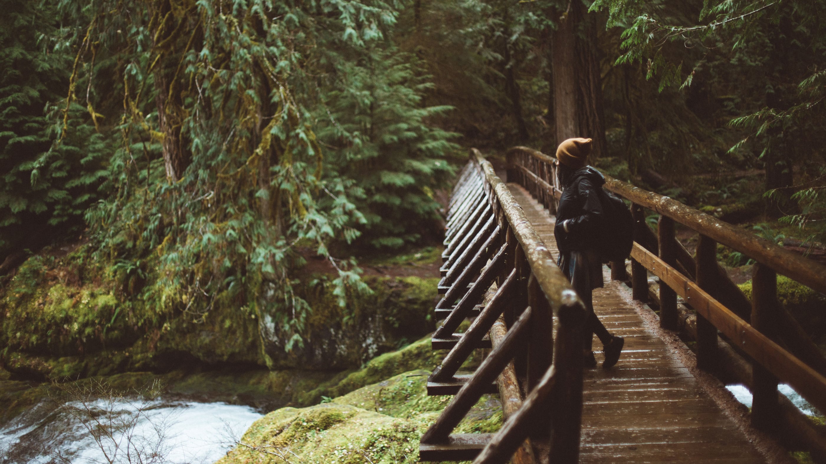
Tryon Creek Loop: 5.7 miles
A mere seven miles from downtown, Tryon Creek State Natural Area is a nature lover's ballpark with second-growth forest, bridges, a wetland boardwalk, and the nature center. Once logged, the park is now a maze of trees and plants, and home to a variety of wildlife, including woodpeckers, rabbits, owls, bats and salamanders. There are eight miles of hiking trails, and while the individual trails are short, you can extend the hike by connecting them. Make sure to grab a map from the visitor center before heading left on the Old Main Trail. The gently graded trails take you beneath a canopy of maples, cedars and alders while you walk along creekside bluffs, through gullies and on several footbridges. Once you reach High Bridge, make a left onto the Douglas-fir-lined Lewis and Clark Trail, which leads you to a very photographic suspension bridge. Follow the North Horse Loop back to the parking lot.
In Portland: From I-5 South, take Exit 297 toward Terwilliger Blvd. Turn right onto Terwilliger Blvd and keep straight for about 2.7 miles, following signs to Tryon Creek State Park. Destination will be on the right.
Wilson River Trail: 4 miles

Year-round access to lush, overgrown forest trails is what makes hiking in this corner of Oregon so darn great. The Coast Range is no exception, and a visit to the stormy Tillamook State Forest is perfect for indulging rainy-day boredom. While the entire Wilson River Corridor is 22 miles long, you'll probably want to choose a section, which is easy to do given there are several trailheads within the corridor. The four-mile-out-and-back segment featured here begins at Jones Creek Trailhead and finishes at Wilson Falls, where you can then opt to either turn back for the trailhead or, if you're feeling adventurous, keep on hiking toward Bridge Creek Falls. The mild trail weaves along the Wilson River through a thick forest of big-leaf maple, alder, cedar and fern. In typical fashion for the moody Coast Range, a dense fog shrouds the entire area, which can look more like a Tim Burton film than anything else. The hike also passes the Tillamook Forest Center, where you can explore the exhibits, get trail maps and climb the 40-foot forest-fire lookout tower replica.
60 minutes from Portland: From 26 West bear left onto Highway 6 toward Banks and Tillamook. Drive 28.9 miles and turn right onto Jones Creek Road. Then drive .1 miles, where you'll pass the Smith Homestead Day Use Area and cross the Wilson River. Turn left into the Jones Creek Day Use Area.
