It's been a hot, dry year in Portland. But rain is coming.
According the National Weather Service of Portland, an "atmospheric river" of moisture is on its way to the Pacific Northwest.
520am: Latest computer forecasts and analyses continue to aim a deep "atmospheric river" of moisture toward SW Washington and NW Oregon. Expect heavy rain and gusty winds tonight into Tue. Curious what an #atmosphericriver is? Learn more here: https://t.co/GZvJeifmR0 #orwx #wawx pic.twitter.com/NtWWanN6YS
— NWS Portland (@NWSPortland) December 17, 2018
Heavy rain is predicted to dump over the city tonight and tomorrow, while wind gusts are expect to reach 45 mph. The downpour will likely cause flooding on Portland roads and could also lead to landslides.
The National Weather Service advises residents in the Portland area to be on alert for debris flows today through Wednesday.
"A debris flow moves faster than a person can run," the advisory cautions. "People, structures and roads located below steep slopes in canyons and near the mouths of canyons may be at serious risk."
NWS says people should track flood watch notices, travel with caution as roadway embankments may fail and evacuate immediately if they see or hear "trees cracking or boulders knocking together."
Data provided to WW's news parter KATU News show a spike in Johnson Creek and Tualatin River water levels, which could also cause minor flooding.
We're about to get slammed with rain here in the PNW.
— Keaton Thomas (@keaton_thomas) December 17, 2018
Here is the river forecast from @NWSPortland. Some rivers may get to action stage or see minor flooding.
Johnson Creek and the Tualatin River will swell in the Porltand area. Several rivers near the coast will too. #LiveOnK2 pic.twitter.com/dpXG2lcp8P
The NWS and Portland Bureau of Transportation are advising people to clear storm drains and gutters today and to prepare for long and potentially dangerous commutes tomorrow morning.
Heavy rain is expected Tuesday morning. Reduced visibility and lingering ponding or road flooding could make your morning commute longer. Remember don't drive across flooded roads. #TurnAroundDontDrown #orwx #wawx #pdxtst pic.twitter.com/vFi1vD1mMV
— NWS Portland (@NWSPortland) December 17, 2018
Those with coastal travel plans may also want to reconsider.
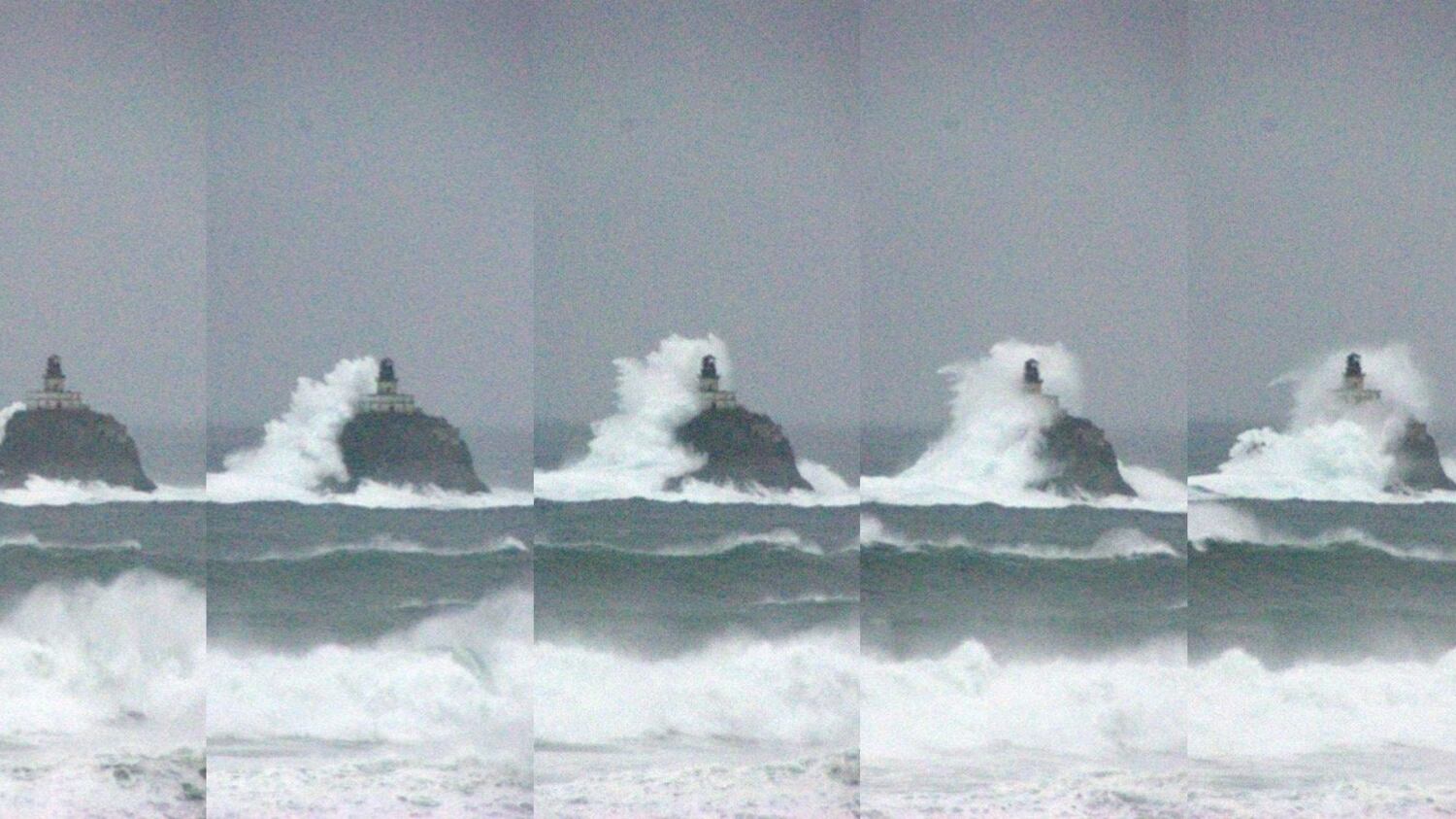
NWS has issued surf advisories along Oregon and California coast, warning that breaking waves could reach heights of 25 to 40 feet.
An off duty NWS employee captured a large wave topping the Tillamook Rock lighthouse this PM. Large seas will continue well into Monday so please stay off jetties & use caution if you plan on visiting beaches along the Oregon and Washington coastline. #pdxtst #orwx #wawx pic.twitter.com/NWoVCxVcDs
— NWS Portland (@NWSPortland) December 17, 2018
"High surf warnings were issued by the NWS from Point Conception, California, to the coast of southwest Washington," the agency notes, "highlighting an especially heightened threat to life and property within the surf zone."