By three measures, 2021 is already on its way to being the most violent year in Portland’s history.
The city is on pace to break its known annual records for homicides (70 in 1987) and traffic deaths (59 in 1996). The city’s fire deaths—11 so far this year—could also challenge an all-time record: 26 in 1975. It is a bleak toll confronting Mike Myers, the former Portland and Las Vegas fire chief hired by the city in March to coordinate its public safety bureaus, which include police, firefighters and 911 dispatchers.
After starting his job, Myers soon noticed a pattern: Most of the deaths—by bullets, speeding cars or flames—are happening in the same places.
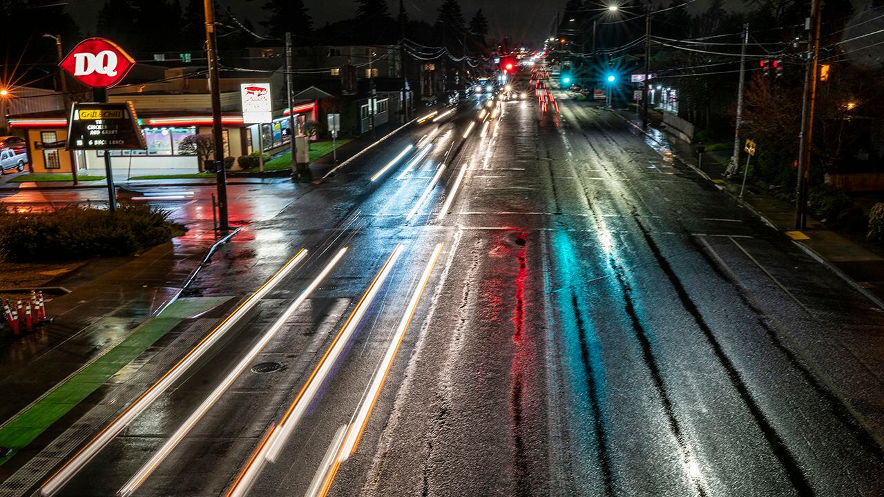
Portland’s violent deaths tend to recur in certain spots, Myers says, most of them east of 82nd Avenue. The intersections where Portlanders are hit by cars are often on the same streets where gunfire erupts.
“There are consistencies in where fire deaths occur, where gun violence occurs, and where pedestrians are getting hit,” Myers says. “Those consistencies are built environment—where your only shopping opportunities are a check-cashing store and a liquor store.”
To some extent, the overlap isn’t surprising. For years, WW and other media organizations have examined the unequal impact of violence on neighborhoods at the eastern outskirts of Portland, where low-income people of color have been shunted for decades.
But Myers goes further: He says city policies created streetscapes whose physical shape makes injury and death inevitable. And he says city investment can make these places safer.
That’s why Dr. Jonathan Jay journeyed to a Safeway parking lot on Aug. 12, looking at the expanse of pavement connecting a Rapid Cash outlet to a tobacco shop along the intersection of Powell and 122nd.
Jay, 38, studies urban health at the Boston University School of Public Health. He runs a project that analyzes crime data to reduce gun violence through environmental improvements—a fancy way of saying he spots the places in a city where shootings occur most often and tries to figure out what makes them prone to bloodshed.
Last week, he toured deep Southeast and Northeast Portland with local experts assembled by Myers, who contracted Jay to tell the city where to invest American Rescue Plan dollars. (The city is expecting $208 million in ARPA funds.) They visited Mount Scott Park, drove up and down 82nd Avenue, and looked at strip malls in Powellhurst.
Jay listened to anecdotes from his tour guides. Now he plans to map violent deaths and use artificial intelligence to guide city investments in safety.
Last week, Jay spoke to WW by phone about what he’s seen and what his data programs can detect. The interview has been edited for brevity and clarity.
WW: There’s a huge debate happening in Portland about whether we need more police intervention to reduce shootings. Do you think that infrastructure projects would reduce shootings?
Dr. Jonathan Jay: We have good evidence from multiple cities that improving the physical environment in urban settings can reduce gun violence. It’s a meaningful, durable effect on gun violence by doing things like addressing serious physical deterioration. Some of my work has looked at the effects of demolishing abandoned buildings in Detroit or improving the condition of vacant lots in Philadelphia and Flint, Michigan. In those cases, turning these really physically distressed places into simple, small parks had considerable effects, without increasing gentrification and without displacing crime and violence to nearby locations.
What kind of problems are you seeing when you drive around Portland?
Lack of parks and other community space. Places where neighbors can congregate and where kids can engage in programming. The preponderance of neighborhoods are physically designed for cars rather than for pedestrians. And so there’s a lot of traffic—in the sense of people moving through—but not a strong sense of community control or neighborhood cohesion.
I get how having highways run through neighborhoods would increase traffic deaths. But how does that increase shootings?
We want to see how well the data corroborates this. But one of the dynamics that we’re hearing about is: If you have a dispute with someone, either because of a group affiliation or just an interpersonal argument, you’ll see them in their car outside the mini-mart or you pass them in traffic as you drive. If a large majority of interactions are happening in out-of-control public spaces—like on roadways—one way to address it is to increase and improve the community spaces where people are better able to self-sort into spaces where they understand who’s going to be there.
Shootings are also occurring in community spaces. Parks created to make East Portland a better place have turned into places where gang members gather in the evenings and shoot at each other. How would more parks fix that?
The solutions to problems that originate in infrastructure aren’t always infrastructure changes. The programming in parks can change the number of people who are in a place at a given time. Midnight basketball is kind of a classic example: The idea is that you’re bringing out community members to a place that otherwise might be unsafe, but because there’s so many, there’s safety in numbers and a stronger community feeling. The place becomes safer.
So what kind of data do you analyze?
These analyses are part of a broader project I’ve got called Shape-Up. It’s based on an algorithm I developed, which uses machine learning to look at aerial imagery and gun violence locations, and to identify high-priority locations based on the aspects of urban form that are visible in these photos—like green space, roadway layout, or vacant lots. Last year, we worked with Albany, New York, to use the algorithm to help decide which abandoned buildings they’ll demolish in the near future. We’ll run this algorithm for Portland in the coming weeks, but we’ll also analyze other factors.
Like what?
We’re looking at things like corner stores, strip clubs and liquor stores. It has sometimes been a matter of looking at zoning and where those kinds of stores will go. But sometimes it’s about empowering neighborhood organizations to exert more control over the spaces around them. It came up in our conversation this week that there was a particularly high concentration of strip clubs in Portland. Strip clubs haven’t come up in my past research. But that may end up being a Portland-specific dynamic.
After the past two days in East Portland, what sticks out in your mind?
The neighborhoods seem to be designed more for cars than for people. And there’s a lot of people who live there.