Fall is arguably one of the best times for hiking in the Pacific Northwest—the other being spring for its wildflowers. But the window for viewing full autumn foliage is short. For a few scarce weeks, vibrant big leaf maples, dogwoods, and Oregon white oak, to name a few, put on a show for those willing to lace up their boots on a now chilly morning and get outside. If you’re in search of autumn adventure, here are four spots within an hour of the city to get your nature fix.
Mount Talbert Nature Park
Miles: 3 | Difficulty: Moderate
Rising 750 feet, Mount Talbert is the largest of the extinct volcanoes that dot the metro area. A stone’s throw from Clackamas Town Center, the nature preserve is covered entirely by trees with 4 miles of trails—some steeper than others. Begin at the Mather Road Trailhead, which has restrooms and a picnic shelter. To the right of the picnic shelter is a short prairie loop with a sign detailing the park’s oak woodland restoration project. To the left of the restrooms, the main trail climbs up through a forest of Douglas fir, maple and birch. To summit, take a left at the Park Loop junction and keep left on the West Ridge junction, where you’ll climb a series of switchbacks under an umbrella of Oregon white oaks. While the view at the top is limited, the hike itself is like walking through a giant kaleidoscope.
Directions: From I-84 east, take exit 6 onto I-205 south and go about 7 miles. Take exit 14 for Sunnyside Road and drive a half-mile, then turn right onto Southeast 97th Avenue. Drive for almost a mile and continue onto Mather Road. The park will be on your left.
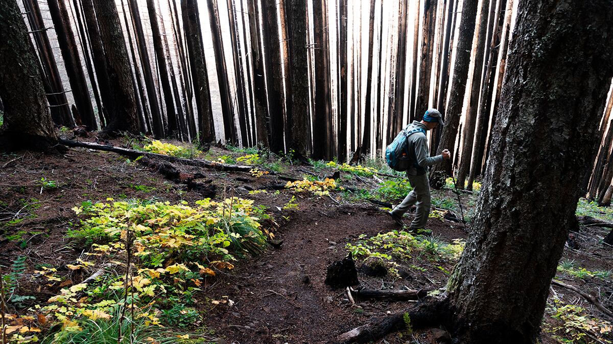
Scaponia County Park
Miles: 1 | Difficulty: Easy
A secluded recreation site along the Crown Zellerbach Trail, Scaponia County Park is situated by the East Fork Nehalem River. In charming, portmanteau fashion, the park is named for its location between Vernonia and Scappoose. The 7-acre nature park offers primitive tent camping—first come, first served. However, even if you’re coming just for the day, a network of trails to explore within the park crosses several footbridges. In fall, yellow maple leaves provide a golden canopy—a nice contrast to the moss-covered forest. Scaponia also connects with the Crown Zellerbach Trail if you’re looking to extend the hike. The whole place is purportedly haunted by the ghost of a horse thief and his dog who were pursued by an angry mob and ultimately met their demise on the banks of the Nehalem. Campers have reported seeing the apparition of the man and his dog walking along the river.
Directions: Take US 30 west for 15 miles before turning left onto Scappoose Vernonia Highway. You’ll continue almost 15 miles before you reach Scaponia County Park on your left. $5 day use fee (bring cash).
Milo McIver Riverbend Loop
Miles: 5 | Difficulty: Moderate
Part of the network of trails in Milo McIver State Park, the Riverbend Loop is a beautiful autumn destination to view a wide variety of deciduous trees. At the Milo McIver Memorial Viewpoint Trailhead, you should be able to ogle Mount Hood, Mount Adams and the Clackamas River before hanging a left onto the Vortex Loop. You’ll come to an impressively large meadow featuring a medley of Douglas fir, red cedar, and vine and big leaf maple where hippies convened for a state-sponsored rock festival in 1970 that was Oregon’s version of Woodstock. Next, you’ll connect with the Riverbend Trail, which meanders along the Clackamas under the glow of golden leaves. Eventually, you’ll reach the Maple Ridge Trail, a mossy, forested area with a colorful mix of Douglas fir, maple, western hemlock, and black cottonwood, to name a few. Loop back along the Riverbend and you’re back on the Vortex Trail. For a shorter hike, park at the Riverbend Trailhead or the Maple Ridge Trailhead.
Directions: From I-84 east, take exit 6 for I-205 south and drive 8 miles before taking exit 13 for OR 224 east toward Estacada/Milwaukie. Turn right onto 224 east, continue for 18 miles, and turn left onto OR 212/224 east. After 1.6 miles, turn right onto 224 east and go a mile before turning right onto Market Road 39/South Springwater Road. You’ll soon make a left onto Springwater and drive 9 miles before you reach the park entrance on your left. $5 day use fee.
Oaks to Wetland Trail
Miles: 1.7 | Difficulty: Easy
A short but scenic loop located in Ridgefield National Wildlife Refuge, the Oaks to Wetland Trail is open year-round and provides lots of opportunities to catch a glimpse of busy wildlife. From late September through November, the 5,217-acre refuge is a destination for an abundance of migrating waterfowl that make it their winter home. The trail is lined with Oregon white oaks, in part due to a 2020 restoration project that removed most of the Douglas firs. Crossing a footbridge, you’ll pass the reconstructed Cathlapotle Plankhouse that marks the village of Cathlapotle, one of the best preserved Native American sites in the Northwest. As you continue past Duck Lake, turn right at the junction and you’ll find oak woodlands filled with copper-tone leaves. You’ll eventually reach the turnaround for the loop. Be sure to check out the viewpoint that overlooks the wetlands and the sign detailing the history of the area as well as a 400-year-old oak tree nearby.
Directions: Take I-5 north into Washington and go 20 miles before taking exit 14 for Pioneer Street/WA 501 west toward Ridgefield. Continue on Pioneer for 4.2 miles, turn left at the traffic circle, and take the first exit to stay on Pioneer. Go a half-mile to the next traffic circle and take the first exit onto North Royle Road. After another mile, turn left onto Northwest 289th Street and, after a mile and a half, turn right on 61st Avenue. Continue onto Northwest 291st Street, which turns into Main Avenue. The trailhead will be on your right. $3 day use fee.