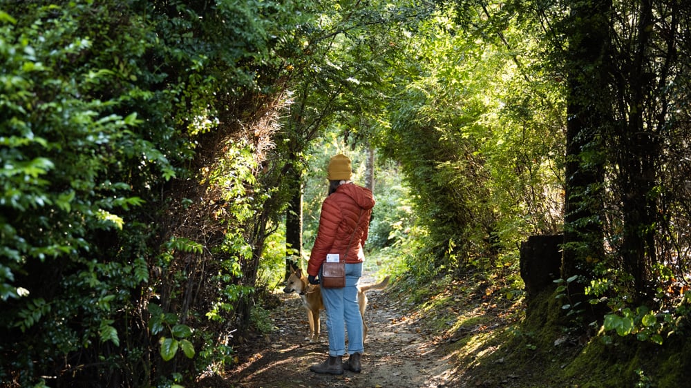
Everybody loves hiking in Oregon during the summer. Literally everybody. If you’ve been on a trail lately, you know that everyone, along with their dog, cat and cousins, is out there making a day of it. But if you have the proper attitude and gear, hiking in winter can deliver you into the warm—OK, chilly—embrace of a forest without the crowds.
But what if you’re not the biggest fan of snow and ice? Maybe you don’t find the thought of driving on or through the slick stuff, let alone hiking on it, all that appealing. That’s OK. You’re not alone and you don’t have to.
Here’s a collection of hikes with a pretty good track record of staying free of snow and ice through the winter. And in the interest of avoiding a trip over a snowy pass, we’ll stay on the west side of the Cascades. Some of these destinations are close in, others farther afield, but all are a fairly safe bet. That said, always check road conditions before you go.

Ecola Point to Indian Beach
Distance: 4.7 miles
Difficulty: **
Coming in just behind Mount Hood and Multnomah Falls as Oregon’s most recognizable landmark, Haystack Rock in Cannon Beach is also one of the most visited attractions on our coast. Despite its popularity, I find myself lured by the beauty of a collection of lesser-known basalt formations about 5 miles north in Ecola State Park.
As with Haystack, you’ve likely been to the recreation area just minutes from the restaurants, gift shops and galleries in town. Most people seem content to stick to the easily accessible grassy bluff near the entrance. There’s plenty to marvel at there, including a breathtaking view south all the way to Cape Falcon, the decommissioned Tillamook Rock Lighthouse (also known as Terrible Tilly because it took 500 brutal days to build in the 1800s), and an Oregon Film Trail interpretive sign pointing out the former location of the Fratelli family’s hideout in The Goonies. Definitely take time to explore all of that, but then press on to the north end of the parking lot. That’s where you’ll find the start of a 4-mile, out-and-back trail to Indian Beach, whose shorter route gives you plenty of time to wander the sand at the turnaround point while still featuring enough switchbacks to qualify as a leg day workout.
You’ll quickly begin to climb through an old-growth Sitka forest with a thick floor of feathery sword ferns, reaching the first good cliff-top view of a cluster of sea stacks of all shapes and sizes—some resembling the jagged back of a dinosaur, others smooth and pillarlike. The most stunning is the arched Sea Lion Rock with a keyhole in the center.
Eventually, you’ll drop into a secondary spruce woods with an abundance of nurse stumps and the occasional rough-skinned newt (don’t touch, they’re toxic!). Once you reach a set of stairs and the canopy thins, you’re nearly to the beach; and what a remarkable cove. There are three distinct layers: a jumble of bone-colored driftwood, a sea of smooth gray stones and, finally, a swath of sand that’s nowhere near as crowded as the shore around Haystack. ANDI PREWITT.
Directions: From Portland, take Highway 26 west toward Tillamook/Astoria for 74 miles. When you reach a fork, keep left and follow signs for U.S. 101 South/Cannon Beach/Tillamook. Continue for just over 3 miles and take the City Center/Ecola State Park exit. Continue onto North Alternative Route 101/Fir Street for one-tenth of a mile, then turn right onto East 5th Street. Take a slight right onto Ecola State Road and you’ll reach the parking lot in about 1.5 miles.
Wilson River Footbridge to the Tillamook Forest Center
Distance: 7 miles
Difficulty: ***
A lazy bend in the Wilson River comes briefly into view as you zip by on Highway 6 in the Coast Range. But the water gains momentum after this kink in its route, gushing under a footbridge, which is the gateway to several walking routes through the Tillamook State Forest. The span is about 100 yards west of the highway shoulder, protected by a concrete barrier. On the other side of the bridge, the briefly indistinct trail veers left back toward Tillamook, but you’ll soon reach a sign that provides clarity. The marker points the way to three different hikes—choose the out-and-back trek to Jones Creek Trailhead for a manageable 7-mile round trip that winds along the Wilson River. Its rapids are almost always within earshot, providing a backdrop that sounds like an unending standing ovation.
The dirt path begins with a gentle climb through a forest of thin, white alders ringed by arching fern fronds. Between steeper pushes uphill and short descents, you’ll notice variety in scenery as well as trail conditions. At times, you’ll cross streams with the help of short bridges; other intersections require hopscotching across rocks to avoid getting your boots wet. And it’s not uncommon to spot snakes darting out of your way along the trail. At one point, the route skirts the base of Wilson Falls, which cascades gently behind a log jam from 100 feet above. Right before Jones Camp, take the suspension bridge across the river to the Tillamook Forest Center—a good turnaround point, which reopens March 1, 2023, after a long pandemic closure. Here, you’ll get a free lesson on nature and history as well as access to restrooms with flushing toilets and running water (unlike the outhouses back at the trailhead).
When you end the hike, don’t miss a waterfall that’s virtually impossible to see from a car on Highway 6. A sign opposite the footbridge announces the isolated Bridge Creek Falls. There’s a series of stone steps leading to the feature that wouldn’t look out of place in a castle. Unlike other area waterfalls, you can walk right up to the water tumbling down the tiers—so close you can practically touch it. ANDI PREWITT.
Directions: From Portland, take Highway 26 west toward Tillamook/Astoria. After about 20 miles, make a slight left onto Highway 6 west (signs for Banks/Tillamook). Continue for 32 miles. The Footbridge Trailhead parking area is on the right at milepost 20.
Sitka Sedge State Natural Area
Distance: Customizable, roughly 4 miles of trails
Difficulty: **
Named after the native grasslike plant found throughout the area, Sitka Sedge is also home to a handful of ecosystems, including tidal flats, saltwater marshlands, wetlands, and coniferous forested dunes. You’ll also get views of Haystack Rock, Cape Lookout, and the wildlife-rich Sand Lake Estuary along almost 4 miles of looping trails that visit every corner of this lesser-known slice of biodiverse heaven in Cloverdale, 20 miles southwest of Tillamook.
The exploring begins on the half-mile, Americans with Disabilities Act-accessible Beltz Dike Trail, a dike constructed in the 1920s. Red alder and Sitka spruce lord over an understory of elderberry, salal, and Western spiraea, before reaching a junction at the end of the dike trail. From there you’ve got a number of loop options. Go right to enjoy the aptly named Estuary View Loop, which, in addition to the wide-open estuary and coastal views, also tours an attractive forest of shore pine.
Another small loop, the Kinnikinnick Woods Loop, explores a fairy-tale landscape comprising dense thickets of dwarf Sitka spruce, shore pine, brightly colored beds of moss and lichen, and the occasional forested tunnel passage—a type of landscape often found on the spits of Tillamook County. The path also visits a seasonal sedge pond, and a number of side-trip viewpoints, including the grassy Elk Knoll, where a bench provides expansive views of the freshwater wetlands. Pick and choose your loops or combine all the trails for a roughly 4-mile outing. ADAM SAWYER.
Directions: From Portland, take Highway 26 for about 20 miles to Highway 6 through the Oregon Coast Range. Yes, the Coast Range does get a little frosty sometimes so, again, check ahead. In Tillamook, take Highway 101 south for 9 miles to Sandlake Road. After 4.3 miles, turn left to stay on Sandlake Road and drive another 4.6 miles to the parking area on the right.
Oxbow Regional Park
Distance: Customizable 7.9-mile loop
Difficulty: ***
The designated Wild and Scenic Sandy River carries snowmelt and glacial till from its source on Mount Hood down to the Columbia River. Oxbow Regional Park ushers the final stretch of that journey with old-growth aplomb. It’s a fine park for camping in the summer and salmon spawning in the fall. And in winter, it’s a choice locale for thriving, electric green moss and lichen.
An almost 8-mile loop visits every section of the park. From marker A, the trail descends to a mixed forest of Douglas fir, Western red cedar, alder, bigleaf maple and cottonwood. After a water tank, three footbridges cross a set of winter-filled creeks. Follow the path left to another footbridge before arriving at marker B.
Make your way across the park road and hike east to another footbridge before arriving at a picnic area. Find the gravel parking area on the left and make your way to marker C and pick up the main trail. The route ascends above the river, with a few spur trails leading to viewpoints. Be careful. You’ll soon pass another picnic area before the trail drops down again to a boat landing. Pick up a paved trail on the other side. You’ll soon spot a traditional hiking trail on the left. Take that path into a verdant patch of consummate Pacific Northwest woods of Western hemlock, Western red cedar and Doug fir. Take a right at the next junction and hike up to a campground. Stay left here and follow the path down to the river. This is a great spot for a snack break if conditions allow it. Keep hiking on the main trail, eventually reaching marker J, which ascends and reaches a service road at marker N.
Continue left into a grove of maples and gain some elevation on your way to a field. Go left to arrive at marker H. The trail continues through cedar groves and passes the south side of a meadow heading through more deciduous woods of alder and maple to marker I, where you’ll go right and head back to the road. Take a left onto the road and hike to marker F. The trail rises and falls down to the road, paralleling it. Walk by more picnic tables and into a serious patch of old growth. Go left and walk down to marker E. Stay left at the next series of junctions, passing through more mature woods. Switchback down to a picnic area and stay left at the next junction. Lose some elevation, cross some creeks, arrive at marker B and continue the final three-quarters of a mile back to the North Oxbow Trailhead. ADAM SAWYER.
Directions: From Portland, take I-84 east to exit 17 for Marine Drive/257th Avenue. Go straight at the first traffic light for a half mile. Turn right onto Southwest 257th Avenue and drive 2.8 miles to Northeast Division Street and turn left. Go 1.2 miles to a stop sign and keep straight on Division. After 1.5 miles, the road curves right and becomes Southeast Oxbow Drive. Go 2.2 miles and make a left onto Oxbow Parkway. Go 1.7 miles to the fee station at Oxbow Regional Park. Continue one-tenth of mile and turn right at a hikers sign onto a gravel road. Park near the trail sign marked A.
Warrior Rock Lighthouse Point
Distance: 7 miles
Difficulty: **
This flat, Sauvie Island saunter parallels the Columbia River out to the northern tip of the island and the small Warrior Rock Lighthouse. Are there grand vistas to behold? No, not really. Is there a majestic old-growth forest to gaze upon? Negative. Can I get there safely and enjoy a nice riverside stroll? You betcha. And, as an added bonus, you get to check out the state’s smallest lighthouse. You will travel through a state wildlife refuge, however, which does require a $10 day pass. But consider it a small price for the opportunity to watch winter wildlife, like bald eagles, sandhill cranes, snow geese and tundra swans. This can also be a muddy trek in winter, so proper footwear is strongly recommended.
From the trailhead, walk through the entry gate and begin a pleasant saunter down a roadbed guarded by cottonwoods, willows and ash. Along the route, you’ll encounter an array of remnants of previous dwellings and farming operations. The path eventually bends around and arrives at the Warrior Rock Lighthouse. Perched on a small rocky outcrop, the diminutive structure is still functional. If you’re interested in continuing on to Warrior Point, the northern tip of Sauvie Island, walk up the beach a short distance and through the woods to a junction and make a right. Continue walking another quarter-mile to the end of the island. Return the way you came. ADAM SAWYER.
Directions: From Portland, take Highway 30 to the Sauvie Island Bridge. Cross the bridge and make a left into the parking lot of the Cracker Barrel Grocery, where you can buy the required Oregon Department of Fish and Wildlife parking permit ($10). Head north from the store for 1.8 miles and make a right onto Northwest Reeder Road. Drive through farmland for 4.3 miles to a stop sign at the intersection with Gillihan Road. Stay straight on Reeder Road for 6.2 miles, where the road turns to gravel. Continue another 2.3 miles to the parking area at the road’s end.
Mount Pisgah Arboretum
Distance: 2 miles
Difficulty: 00
The stellar Howard Buford Recreation Area, about 9 miles east of Eugene, is home to a ton of great stuff for outdoor enthusiasts. Those looking for a bit of a challenge can choose any number of ways to tackle the popular 1,531-foot Mount Pisgah, with its expansive views and wildflower meadows. Those in the market for an easy winter day hike will find equally numerous and enthralling options at the mountain’s namesake arboretum.
From the trailhead kiosk, start out on the gravel Summit Trail 1, keeping straight, then veering right at an almost immediate junction with the Theodore Trail 17. The broad path climbs somewhat aggressively through an attractive grove of mature oaks. There’s good and bad news here. The bad news is that a big climb is a rude way to warm you up for a hike. The good news is that once you get on the Oak Savanna Trail, you’ll have gained most of the day’s elevation.
The path then descends steeply into an invitingly open savanna dotted with oaks. After crossing a set of footbridges, stay straight at a four-way junction onto the North Boundary Trail. The old roadbed soon becomes a more official footpath that bends through a series of thickly lichened clusters of oaks. Continue through the trees and stay left at the next junction. The trail emerges from the trees and arrives at a junction. Stay straight here, onto the Lower Plateau Trail.
The path drops into another magical oak grove before arriving at a picturesque junction with the Buford Trail. Go right and arrive at the Oak Woodlands Exhibit. The arboretum features artistic displays that provide information about the different habitats. The trail soon bends around and enters a lush forest, where things begin to change noticeably. Arrive at a junction with the Hillside Trail and keep straight veering left to stay on the Buford Trail. The forest morphs briefly into a landscape dominated by Doug fir until the path arrives at a junction with the Incense Cedar Trail. Make a hard left here and you’ll soon pass by a few large examples of the species before arriving at a junction, where you will continue straight and encounter the Incense Cedar Exhibit.
Beyond the incense cedars, the trail reenters oak territory. Stay straight, veering right at a junction with the Jette Trail and loop around and down to a junction, where you will go straight onto the Pond Lily Trail. Make a left, over the Vern Adkison Bridge, and go right to visit the Wetlands Exhibit, then continue straight to a junction with Meadow Road, where you’ll go right. With the Coast Fork of the Willamette River now in sight, make a left at a junction with Quarry Road. Pass by a barn and go left at a junction onto the Riverbank Trail. Follow this path along the river back to the trailhead parking area and the end of the loop. ADAM SAWYER.
Directions: From Eugene, take I-5 south for 3.5 miles and get off at exit 189. Turn right onto Highway 225 and drive 0.6 miles. Make a left on East 30th Avenue followed by an immediate left onto Franklin Boulevard. Drive 0.2 miles and make a right onto Franklin Boulevard East. Continue 0.4 miles and take a left onto Seavey Loop Road. Drive 1.5 miles and just after a bridged crossing of the Coast Fork of the Willamette River, turn right onto Frank Parrish Road and into the arboretum. Continue to the trailhead parking area on the right.

South Slough National Estuarine Research Reserve
Distance: 3.8 miles
Difficulty: **
The phrases “under the radar” and “hidden gem” are somewhat overused and often less than accurate. That is not the case with what Coos Bay locals call simply the “South Slough.” A mix of traditional trails and boardwalks visit a wildly diverse landscape of open water channels, tidal and freshwater wetlands, riparian areas and forested uplands. A handful of trailheads are located around the reserve, but perhaps the best place to start is at the South Slough National Estuary Interpretive Center. All the trails are good for the family, and some paths are dog friendly.
Start by taking the 10-Minute Loop Trail into a very dense thicket of salal and evergreen huckleberry. Go right at a junction with the North Creek Trail and cross a footbridge. Continue hiking to a junction with the Middle Creek Trail. Take this path down through a dark forest to a paved road. Cross carefully and make a left onto Hidden Creek Trail. The path switchbacks and descends before arriving at a set of boardwalks that briefly offers a choose-your-own-adventure route across a gorgeous wetland area. The boardwalk delivers you back into the woods and a viewing platform overlooking the marsh.
From the viewing platform, head back to the Tunnel Trail. The aptly named path guides you through dense shrubbery to a set of restrooms that may or may not be open. The trail then drops back down to the water. Take the North Creek Trail along a dike and over a footbridge offering excellent views in all directions. Then ascend into a stately forest of Sitka spruce, Douglas fir, and Port Orford cedar before gradually descending to North Creek. Cross a significant number of footbridges, then traverse in and out of a series of gullies before arriving at the junction with the 10-Minute Loop Trail. Go right to arrive back at the interpretive center. ADAM SAWYER. PHOTOS BY CHRISTOPHER VALENTINE.
Directions: From Portland, take I-5 south for 137 miles to Highway 38. Travel west to the coast for 50 miles and take Highway 101 south to North Bend. Take Highway 540 through Charleston and make a left onto Seven Devils Road and drive 4 miles to the South Slough National Estuary Interpretive Center on the left.