Let's face it, folks. We're not going to be able to visit many of our favorite waterfalls this summer.
The Gorge's lineup of greatest hits—from Horsetail to Bridal Veil to Multnomah, the corridor's crown jewel—all remain off limits more than three months after Oregon's public lands agencies closed those recreation sites to help halt the spread of the coronavirus. And if attractions do see a late-season reopening, we understand if you're less than eager to rush back to trails clogged with what feels like half the metro area looking to escape.
For this year's Summer Guide, we decided to scope out some of the most spectacular cascades that are not in the Columbia River Gorge's famed alley of falls. That way, when the next 90-degree day hits and you're itching to cool off in a shower created by nature, you'll have some choices that typically aren't swamped with people, even in times with no pandemic. And you may just discover something new in your state along the way.
Difficulty Key:
* Parks Scare Me
** Dirty Boots
*** Weekend Warrior
**** Sasquatch
Pup Creek Falls
Difficulty: Weekend Warrior
Distance: 7.8 miles
The hike to Pup Creek Falls is always varied and never dull, matching the mood of the river it follows. At times, the route quickly and aggressively surges upward before plunging in elevation, just like the rapids in the mighty Clackamas below the trail. Other times, the path undulates, mirroring the gentler sections of water, and occasionally gives you a break by staying as level as the placid stretches preferred by beer-guzzling floaters.
It's always a bit of a surprise this trek isn't more heavily populated—besides offering a stunning turnaround point in the form of a falls that slaloms down a series of rocks, the pathway is also mostly shaded by towering Doug firs and Western red cedars with beefy trunks, making it a pleasant jaunt even when Northwest temperatures spike.
From the Fish Creek Trailhead parking lot, walk across the road that brought you here and head toward the brown sign pointing the way to Clackamas River Trail No. 715. Before ducking into the forest, you'll notice a bench that can fit about two people. It's an odd placement, to be sure, since it's at the beginning of the outing—the furniture would be most useful for someone to pause and consult their directions before setting out, or perhaps it's there as a safeguard for an exhausted return hiker whose legs can't trudge another few feet to the car. No matter its purpose, the bench seems to be a sign you're in for a special hike—if you look closely, you can spot trinkets, like a toy car, an 8 ball and a set of dice, embedded in the seat.
After pausing to admire the quirky welcome, you'll push through the woods on a flat path that quickly veers toward the river: teal and calm at first, then gray and choppy. Though the trail bobs and weaves, sometimes through streams or darkened groves filled with ferns, it almost always sticks with the Clackamas, where you can spot everything from experienced rafters charging through the roaring waves to people lounging in inner tubes that aren't going anywhere.
While the views almost give you the sense you're on the water with them, keep your eyes on the route when moving. Whether it's a garter snake darting into the brush or sheer cliffs that are a stumble away from a several-hundred-foot drop into the river, this trail keeps you on your toes. Once you catch sight of a marker directing you to an offshoot to the right, you're close to what you came for.
Leaving the river and following Pup Creek for 0.2 miles will run you smack dab into the falls. From 240 feet up, a strand of water plummets onto two tiers of rocks. Take a seat on a small outcropping and let the spray cool your clammy skin. After soaking it all in, return the way you came. Or, if the Clackamas Wilderness captured your soul like it did ours, stay a while longer by making a night of it at one of the two primitive campsites you passed on the way in. ANDI PREWITT.
Directions: From Portland, take Oregon Route 224 east toward Clackamas/Estacada. Just after crossing the Clackamas River in the town of Carver, turn left onto South Springwater Road. After about 10.5 miles, make a left on South Hayden Road, drive for a little more than a mile, then turn left again onto Oregon Route 211 north. A mile later, veer right onto Oregon Route 224 east, just skirting the south end of Estacada. After nearly 15 miles, you'll turn right on Fish Creek Road to reach the parking lot for the Fish Creek Trailhead.
Shellburg Falls
Difficulty: parks scare me
Distance: 3 miles
Ever since Silver Falls State Park began welcoming back visitors in mid-May, it has been smothered in love. Oregon State Parks and Recreation warns would-be visitors that the park quickly reaches maximum capacity on weekends. If you're looking for a similar experience but want to steer clear of crowds, all you need to do is drive 20 minutes farther south. That's where you'll find this hike, which may not boast a network of 10 waterfalls like the Silver Falls area, but does reward with two that are geologically similar to those at the park, including one that you can walk behind.
The route begins at a yellow gate meant to block vehicles, not people, and the first of many cattle grates along the gravel road. As you amble up a very gentle hill, the land on either side of you is private property, which means you'll pass a mosaic of wild and maintained vegetation, like mowed fields and Christmas tree farms, which are still pretty enough to look at. Bell-shaped fuchsia foxgloves respect no boundaries and bloom everywhere in late June.
Eventually, you'll come to see why this path has so many livestock grids: A sign on a tree alerts dog owners to keep their pets leashed because cattle lie ahead. Hiking websites will tell you that cows sometimes join people on their afternoon stroll, and open gates attest to their ability to access the route. But on my visit, not a single bovine appeared interested in aerobic activity as the herd lazed around in a flower-dotted meadow.
About a mile in, a wooden sign declares you're entering the Santiam State Forest, and all evidence of agricultural activity are shed. You'll soon reach Lower Shellburg Falls, though only a few feet of spurting water is visible. The more impressive drop is just 0.3 miles away. The Upper Shellburg spills out of a curved basalt wall that over thousands of years has created a grotto so grand it feels like entering a church sanctuary. Continue your holy experience by peeking behind the cascading curtain. The route slices behind the falls, where you can then sit on a bench and watch in awe. No matter how many times you've done it, being on the other side of a waterfall always feels as though you've discovered the world's purest secret. ANDI PREWITT.
Directions: From Portland, take Interstate 5 south and get off at exit 253 for Oregon Route 22 toward Detroit Lake/Bend, making a left onto 22 and following that for a little more than 20 miles. Turn left onto Teeters Road just after passing Stayton and quickly make a slight right onto Wagner Road. After approximately 2.5 miles, Wagner Road veers right, so stay straight to continue on Ayers Creek Road. A little more than 2 miles later, the tiny parking area for the trailhead appears on the left.
Beaver Falls
Difficulty: Parks Scare Me
Distance: 0.7 miles
If you reach Astoria, you've passed it. Beaver Falls Road, a section of old Highway 30 a few miles east of Clatskanie, boasts some of the same features that make its Columbia River Gorge counterparts famous, though admittedly on a much smaller scale. The winding road to the falls crosses over a number of historic bridges accented with familiar-looking guardrails, as well as the surprisingly nice and seemingly out-of-place cascade of Upper Beaver Falls. The short 0.7-mile out-and-back trail to the amphitheater containing the broad, curtainlike Beaver Falls is not an officially maintained path. But it's fairly well-graded and quite pleasant for a stroll. Follow arrows on trees whenever you encounter a questionable junction with another user path and you'll be fine. Be forewarned, however, the area becomes a popular swimming hole in summer.
ADAM SAWYER.
Directions: From Portland, take Highway 30 west toward Astoria for a little more than 50 miles. Veer right onto Beaver Falls Road and drive nearly 4 miles to a large parking pullout on your left. Walk back toward the road and pick up the user trail near the northeast corner of the pullout.
Niagara/Pheasant Creek Falls
Difficulty: Dirty Boots
Distance: 2 miles
The drive is long and convoluted at times, and the trek is short—2 miles out and back. But a pair of dueling 120-foot waterfalls combine to make this one of the best easy hikes in the North Coast Range. Despite the undemanding route, you're likely to find no more than a handful of cars at the trailhead, especially on a weekday. There's some dispute within the waterfall community which waterfall is which. Some very reputable sources claim the first waterfall is actually Niagara Falls, while the second cascade at the end of the trail is Pheasant Creek Falls. Other esteemed sources declare the opposite. Either way, both are well over 100 feet tall, and it's a debate I am no longer willing to entertain. There's also a well-placed picnic table at the end of the trail, so don't be afraid to pack a lunch and extend the trip a little. After all, it was kind of a long drive. ADAM SAWYER.
Directions: From Tillamook, take Highway 101 south for 14.5 miles and make a left onto Blaine Road. Drive about 6.5 miles to Blaine Junction, bearing east on Upper Nestucca River Road for nearly 6 miles to reach Forest Service Road 8533. Go south about 4.5 miles to Forest Service Road 8533-131. Turn right at the junction and travel 0.7 miles to the trailhead parking area.
University Falls
Difficulty: Parks Scare Me
Distance: 0.7 or 6.6 miles
Make no mistake, the 0.7-mile out-and-back to University Falls is not an untouched forest retreat. There's no old growth to be found, nor are you likely to encounter much solitude. The area is a popular spot for ATV and horseback riders, so there might be some noise pollution to contend with as well. Now that you've been sufficiently warned, it's a solid leg-stretch at the top of the Coast Range if you're headed to Tillamook. The forest is dominated by red alder, which differentiates it from your standard outing on the west side of the Cascades. And if you're open to some non-waterfall hiking, there are some other excellent options in the area, including Gales and Step creeks.
If a less-than-a-mile traipse through the woods just doesn't seem worth pulling off the road for, you're in luck because there is a longer route that winds its way through the Tillamook State Forest to reach the 80-foot falls cascading down basalt rock that's 15 million years old. The gateway to this hike looks dreary, but don't let that deter you. In fact, it may help keep the throngs of nature lovers at bay. The trail is tucked behind an Oregon Department of Transportation yard lined with concrete barriers at Rogers Camp, where, yes, you will still probably hear the incessant drone of ATVs as well as occasional gunfire. Rest assured, the noise fades once you enter the forest.
Skinny, white alders crowd around Elliot Creek, which accompanies you much of the way to the falls. Near a horse-hitching area, you'll spot a sign with an artist's rendering of the water feature—you're almost there. While there's not a lot of space to spread out in front of the cooling mist, you shouldn't have to worry about that. Most of the suckers probably went to the Gorge to see what, if anything, has reopened. ADAM SAWYER and ANDI PREWITT.
Directions for the 0.7-mile hike: From Portland, head west on Highway 26 for 20 miles and take a slight left onto Oregon Route 6. Drive for nearly 19 miles. Following signs for University Falls, make a left onto Saddle Mountain Road. The route soon approaches a T junction. Make a right here and follow signs to University Falls for 3.5 miles. Look for a small pullout and the trailhead on the right.
Directions for the 6.6-mile hike: From Portland, follow Highway 26 west and bear left onto Oregon Route 6. Turn left at the Rogers Camp Trailhead and Browns Camp. Make another left on the gravel road for the Rogers Camp parking lot.
Sweet Creek Falls
Difficulty: Dirty Boots
Distance: 5.2 miles
The 5.2-mile out-and-back hike along Sweet Creek is an absolute joy. The peaceful walk through a substantial old growth forest visits a handful of smaller cascades before reaching a fenced viewpoint of the hike's namesake falls. While there is some small debate about the exact number of legitimate and named falls, there are at least two: Sweet Creek and Annice. However many there might actually be, it's a short hike you won't regret. The trail itself is also remarkable, at one point squeezing through a narrow gorge along catwalks bolted to the canyon walls. Expect an epic trillium display in spring, an explorable multitier creek in summer, and a nature photographer's dreamscape in fall. ADAM SAWYER.
Directions: From Eugene, take Oregon Route 126 west for 46 miles. Just before the bridge crossing into the town of Mapleton, make a left onto Sweet Creek Road and drive 10 miles to the Homestead Trailhead parking area on the right.
Pandemic Trail Etiquette
Follow these tips to hike safely, and courteously, during the COVID-19 era.
• Mask up: You're in the great outdoors, so it should be easy to spread out, right? Yes and no. Many narrow trails do not have shoulders big enough for people to step 6 feet aside while others pass, so you should slip on your face covering in tight spots.
• Use your elbow as a hanger: No one wants to wear a mask the entire hike, particularly on strenuous routes. Either don a bandanna around your neck that you can pull up to cover your face when needed, or loop your arm through your mask's ear straps if not in use. The crook of your elbow is the perfect spot to store it for both comfort and access.
• Keep moving: When a hiker steps aside for you to pass, do so quickly. Pausing to gawk at scenery, or simply freezing like a stunned deer, not only wastes their time; you're also prolonging your interaction in close proximity to one another.
• Sanitize: Do not expect to find soap and running water or sanitizer stations at trailheads. You're not at Fred Meyer. Be sure to bring your own in case you need to use the toilet, if one is provided at the trailhead, or after you've buried your cathole.
The Vintages Offer Pint-Sized Luxury Living for Your Inner King of the Road
If Old MacDonald Had a Winery, It Would Look Like Abbey Road Farm
Island and Native American Culture Collide Beautifully in an Unlikely Port Town on the Columbia
Lane County Boasts More Covered Bridges Than Any Other West of the Mississippi. We Ranked Them.
As One of the Only Safe Ways for the Public to Gather, Newberg's 99W Drive-In Is the Hottest Nightspot in Town
With Some Campgrounds Still Closed and the Coronavirus Spreading, I Went Camping in the Only Place That Was a Safe Bet—My Backyard
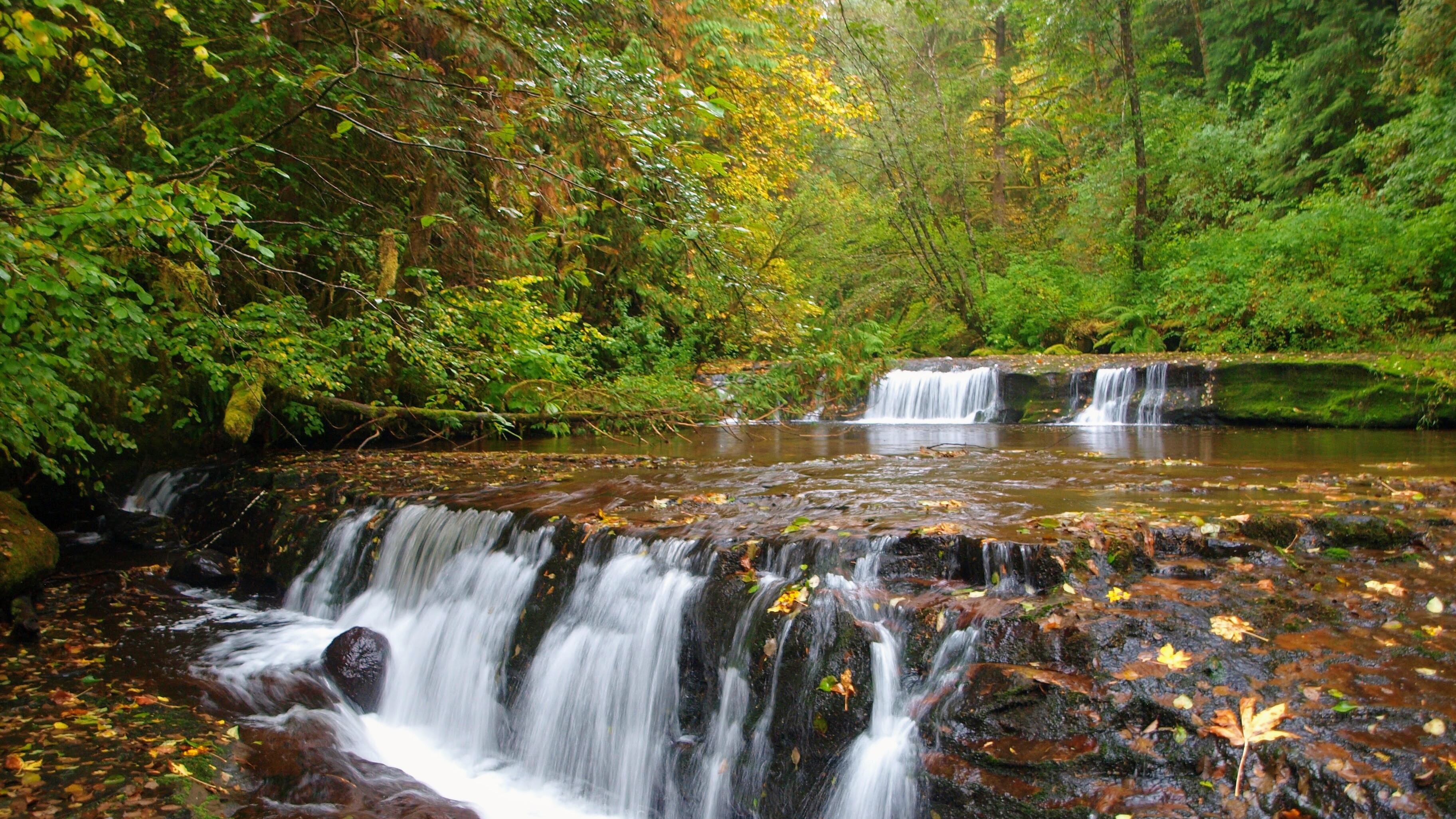
We Found Trails to Six Lesser-Known Cascading Gems That Will Fulfill Your Urge to Get Wet This Summer
This One-Room Structure Now Shelters Weary Hikers and Features a Decently Stocked Pantry
Florence Has Named a Park After the Legendary 1970 Whale Explosion
Support Local Breweries by Drinking on a Recently Reopened Patio, or Take Your Beer to Go
Washington's Northwest Trek Wildlife Park Now Offers a Drive-Thru Safari. So We Tried It Out.